

NIMBO Terrain-RGB
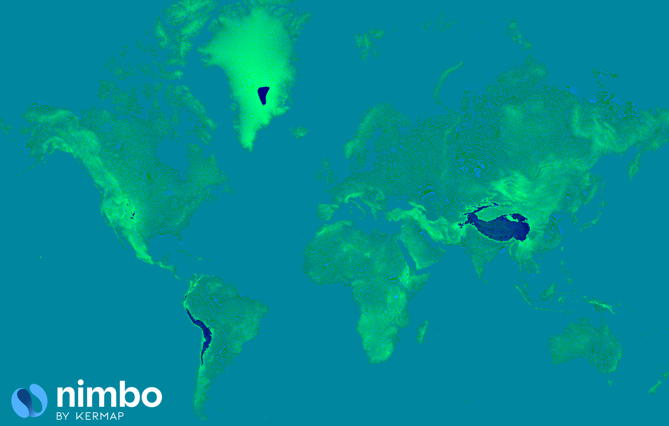
NIMBO Terrain (RGB DEM)
Overview
Section titled “Overview”Terrain-RGB encoded elevation tiles for 3D visualization, assembled from identified international and national sources on continental surfaces. DTM or DSM nature and accuracy depend on the sources; served pixel spacing varies with zoom and latitude.
Elevation can represent a digital terrain model (DTM) or a digital surface model (DSM), depending on the source. Some source heights can include surface features rather than bare ground. Accuracy depends on the source; a common harmonization process has not been confirmed.
Terrain-RGB and its derived relief products concern continental surfaces. Exact footprint boundaries and NoData areas have not been confirmed; a continental extent is not proof of a populated tile at every location.
Use in GIS · Catalogue and service settings
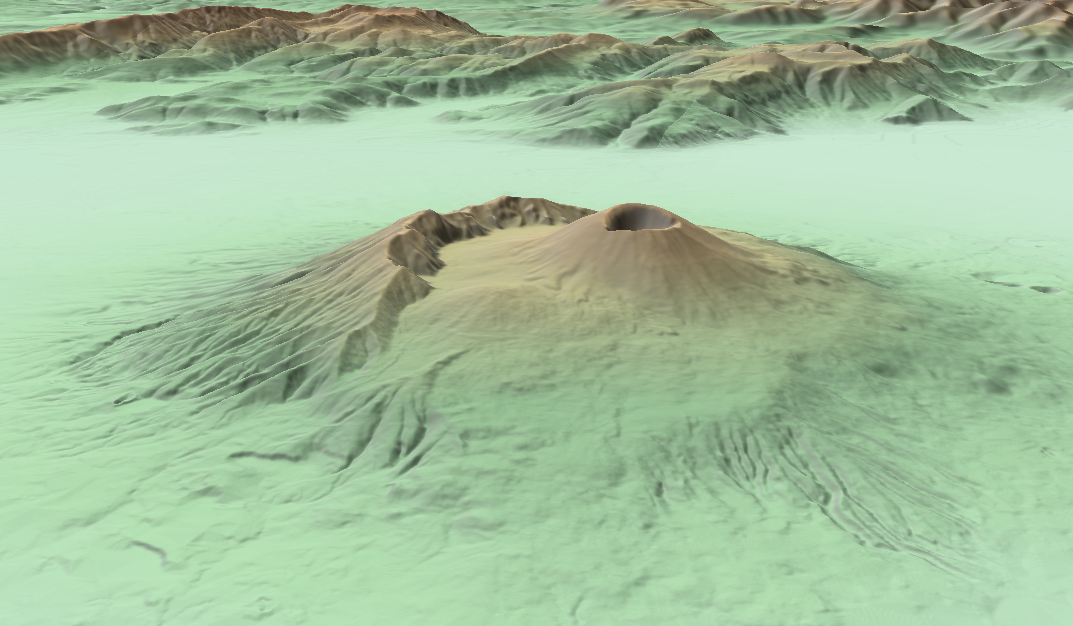
3D view of Mount Vesuvius (Italy) made with Nimbo Terrain (RGB DEM)
Specifications
Section titled “Specifications”| Property | Description |
|---|---|
| Coverage | Continental surfaces; exact footprint unconfirmed |
| Source resolution | Variable; documented source-grid examples are qualified in the catalogue |
| Zoom Level | 0–16 advertised by TileJSON; availability varies by area |
| Update frequency | Static; revision policy unconfirmed |
| Access | XYZ tiles; extensionless URLs |
| Tile format | 512 × 512 WebP for non-empty sampled terrain tiles |
| Coordinate grid | Web Mercator (EPSG:3857) |
| Served pixel spacing | Varies with zoom and latitude; not native source resolution |
The served tile grid is Web Mercator. Matching a map grid does not establish source accuracy or a shared vertical datum.
RGB DEM format
Section titled “RGB DEM format”NIMBO Global DEM is distributed as an RGB-encoded elevation model, following the same core specifications as the Mapbox Terrain-DEM v1:
- Available zooms: the NIMBO service advertises levels 0–16; populated levels depend on the area.
- Documented sources: the references below describe upstream datasets; the current production source inventory and editions require confirmation.
- Tile grid: the service uses Web Mercator; this does not establish common source resolution or positional accuracy.
How RGB encoding works
Section titled “How RGB encoding works”In this format, elevation values are encoded in the red, green and blue channels. The verified NIMBO endpoint returns non-empty 512 × 512 WebP tiles. Request the URL without a file extension and decode it as Terrain-RGB.
Each color triplet (R, G, B) represents an elevation value using the following formula:
height = -10000 + ((R * 256 * 256 + G * 256 + B) * 0.1)- R, G, B: 8-bit integer values (0–255) from each channel
- height: decoded elevation in metres. The service response does not specify one common vertical datum or vertical accuracy for all upstream sources.
Example:
R = 1, G = 136, B = 240height = -10000 + ((1 × 256² + 136 × 256 + 240) × 0.1) = -10000 + (100592 × 0.1) = 59.2 mFor Terrain-RGB, each source is converted to RGB DEM, then reprojected and integrated in a TMS tiling system in EPSG:3857. The WebP encoding is lossless. The published endpoint uses the documented XYZ connection settings. Resampling, zoom generation and final vertical accuracy have not been confirmed.
Terrain-RGB represents encoded heights in 0.1 m steps. This is not a 0.1 m vertical-accuracy guarantee.
Advantages of the RGB DEM format
Section titled “Advantages of the RGB DEM format”- Web-native: served as XYZ image tiles at extensionless
/z/x/yURLs - Cross-compatible: works out of the box in 2D and 3D rendering engines
- Encoding increment: the decoding formula has a 0.1 m increment; this does not establish the accuracy or effective precision of the source DEM
- Map grid: Web Mercator tile positions; alignment does not establish a shared source resolution or vertical reference.
Sources
Section titled “Sources”The identified global and national sources are listed below. The list and upstream native grids do not identify the exact editions, acquisition dates, source priorities or resampling used in a NIMBO tile. Source attribution notices do not constitute a complete dataset licence.
| Source / area | Native grid | Publisher / attribution |
|---|---|---|
| SRTM (NASA) Global source | 30 m | NASA SRTM (NASA) Source reference |
| Copernicus GLO-30 (ESA) Global source | Approximately 30 m | ESA / Copernicus Produced using Copernicus WorldDEM-30 © DLR e.V. 2010–2014 and © Airbus Defence and Space GmbH 2014–2018 provided under COPERNICUS by the European Union and ESA; all rights reserved. Source reference |
| DGM Österreich Austria | 10 m | BEV / data.gv.at DGM Österreich — BEV / data.gv.at Source reference |
| RGE ALTI France | 1–5 m | IGN RGE ALTI® — IGN Source reference |
| TINITALY DEM Italy | 10 m | INGV / University of Florence TINITALY DEM — INGV / University of Florence Source reference |
| MDT05 Spain | 5 m | IGN-CNIG MDT05 — IGN-CNIG Source reference |
| Markhöjdmodell (GSD-Höjddata grid 2+) Sweden | 2 m | Lantmäteriet Markhöjdmodell (GSD-Höjddata grid 2+) — Lantmäteriet Source reference |
| SwissAltiRegio Switzerland | 10 m | Swisstopo SwissAltiRegio — Swisstopo Source reference |
| USGS 1/3 arc-second DEM United States | Approximately 10 m | USGS USGS 1/3 arc-second DEM (NED/3DEP) Source reference |
Licensing & attribution
Section titled “Licensing & attribution”The source-specific credits above apply where that source has been used. They do not identify the exact source edition in a delivered tile or constitute a complete NIMBO licence. Ask NIMBO for the applicable sources and terms for your area.
Access examples
Section titled “Access examples”XYZ access
https://prod-data.nimbo.earth/tiles/terrain-dem/{z}/{x}/{y}?kermap_token=<YOUR_TOKEN>The DEM integrates seamlessly with NIMBO’s 10 m and 2.5 m optical layers, allowing real 3D visualizations in MapLibre or QGIS using hillshade or slope rendering.
Integration ideas
Section titled “Integration ideas”Use Terrain-RGB to construct terrain meshes, visualize relief and drape satellite imagery in a 3D scene. Confirm source properties before measurement or analysis.
Native source resolution, served pixel spacing, encoding step and vertical accuracy are different properties. Vertical accuracy depends on the source. Vertical references, resampling and source-specific accuracy measurements have not been confirmed. Hydrological and other demanding analytical uses require corresponding validation.
Terrain-RGB represents encoded heights in 0.1 m steps. This is not a 0.1 m vertical-accuracy guarantee.
Technical notes
Section titled “Technical notes”- Tile positions use Web Mercator (EPSG:3857); decoded heights use metres. Horizontal projection and vertical reference are separate properties.
- Availability and maximum populated zoom vary by area; an HTTP 200 response can contain a transparent no-data tile.
- Source harmonization and vertical reference transformations have not been established.
- The checked endpoint uses XYZ tiles with a north-origin row index.
⚡ Tip: In QGIS, use the NIMBO DEM as the elevation source for hillshade or 3D map views.
Summary
Section titled “Summary”This is a static product without a monthly archive. Source acquisition dates, the current dataset version, revision dates and the update schedule have not been supplied.
| Layer | Discovery | Pro | Pro HD | Enterprise |
|---|---|---|---|---|
| Terrain-RGB elevation | Evaluation | Included | Included | On agreement |
- Terrain-RGB elevation: XYZ.
Modes listed apply only to the documented combinations. “To confirm” includes missing rules. Evaluation, on-request and agreement conditions, delivery methods and any differences by mode are listed below.
Need help?
Section titled “Need help?”Contact support@nimbo.earth or visit nimbo.earth/products
Service verification
Section titled “Service verification”Checked on 2026-09-30 with an authenticated account. TileJSON is available at:
https://prod-data.nimbo.earth/tiles/terrain-dem?kermap_token=<YOUR_TOKEN>It advertises zooms 0–16. Paris returned elevation through zoom 14 and HTTP 204 at 15–16; Stockholm returned elevation at 15–16. Zoom 17 was rejected. Configure the client for the highest populated zoom in your area.
Non-empty samples were 512 × 512 WebP. An ocean no-data sample returned a transparent 256 × 256 PNG. A successful HTTP status alone does not prove usable elevation, a complete footprint or vertical accuracy.
The TileJSON response includes the supplied token in its tile URLs; redact it before sharing metadata. See the catalogue record for the verified service settings and the limits of the observations.