

Explore and compare monthly satellite imagery
View any location, select a month, switch imagery layers and compare changes over time.
Open Earth Online
Example: the 2025 Palisades Fire
Section titled “Example: the 2025 Palisades Fire”In this guide, we explore the area affected by the January 2025 Palisades Fire in Los Angeles, California, around Topanga and the Santa Monica Mountains.
By comparing imagery from February 2024 and February 2025, you can see the area before and after the wildfire and explore the changes directly in NIMBO Earth Online.
The examples below open directly in NIMBO Earth Online. You just need to be signed in.
Explore in four steps
Section titled “Explore in four steps”-
Search for a location
Use the search bar to find a city, region or area of interest.
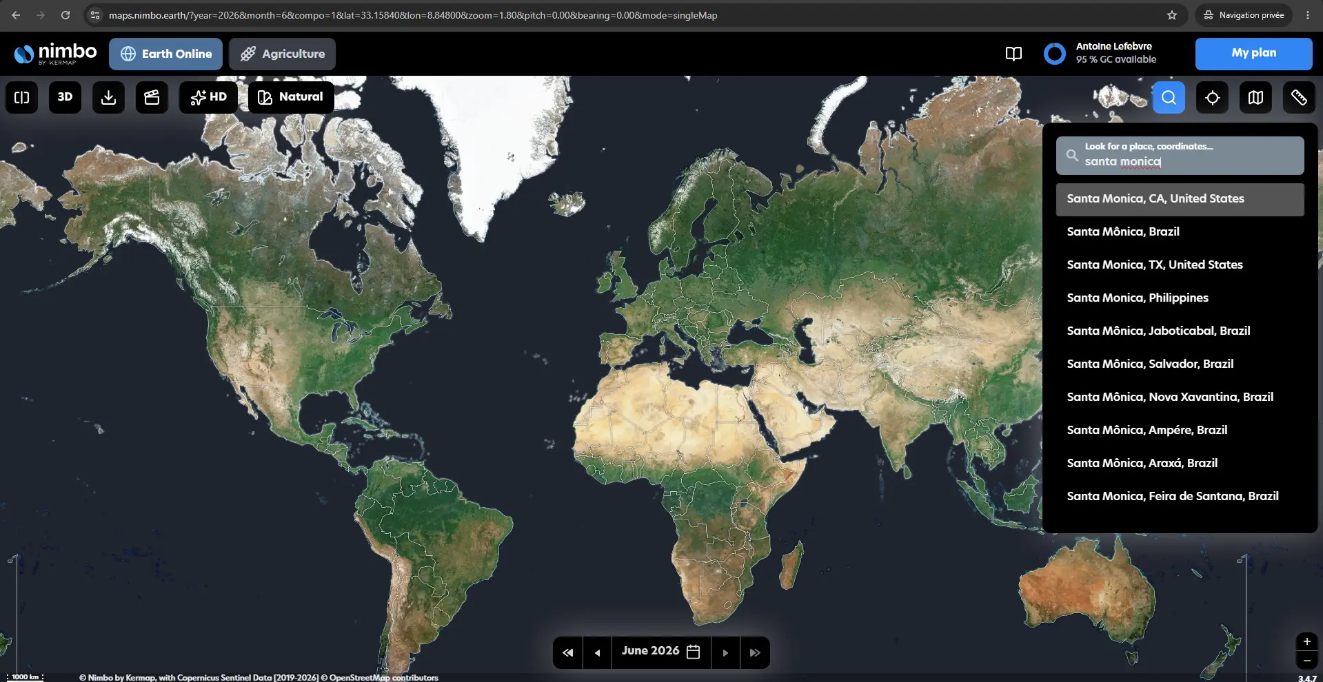
Use the search bar to quickly navigate to your area of interest.
Open this example
-
Select a month
Choose the month you want to explore. NIMBO provides monthly satellite imagery, making it easy to navigate through time and revisit the same area at different dates.
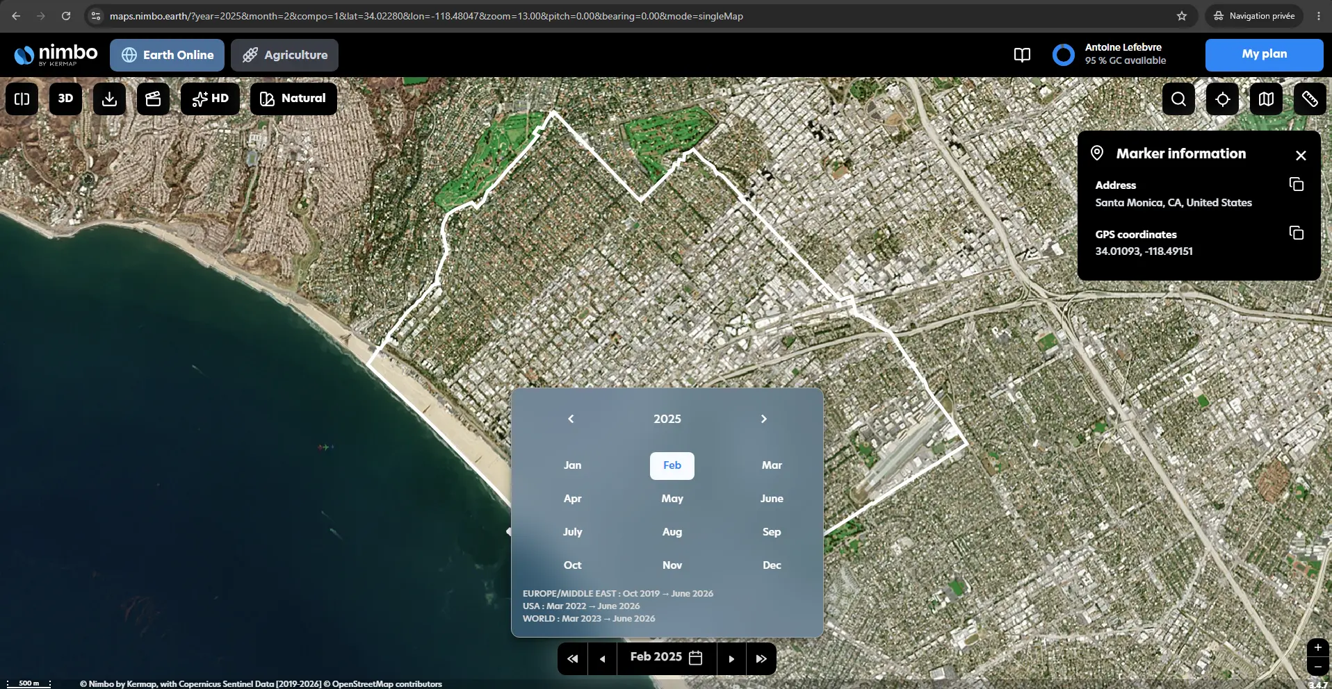
Select a month to view satellite imagery for a specific period.
View February 2024
-
Activate comparison mode
Activate comparison mode to display two dates side by side and identify changes over time.
In this example, compare February 2024 with February 2025 to see the landscape before and after the January 2025 Palisades Fire.
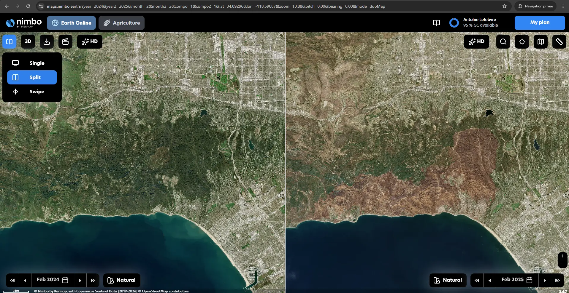
Compare February 2024 and February 2025 imagery to observe the impact of the January 2025 Palisades Fire.
View the Palisades Fire comparison
-
Switch imagery layers
Switch imagery layers to explore the same location using different satellite data visualizations.
For example, change from RGB to Near Infrared (NIR) to reveal landscape and vegetation patterns that may be less visible in natural color imagery.
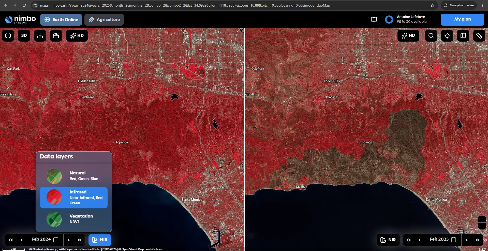
Switch between imagery layers such as RGB and Near Infrared to explore the area from a different perspective.
View in Near Infrared
Go further with 3D
Section titled “Go further with 3D”You can also switch to 3D view to explore satellite imagery together with terrain and elevation.
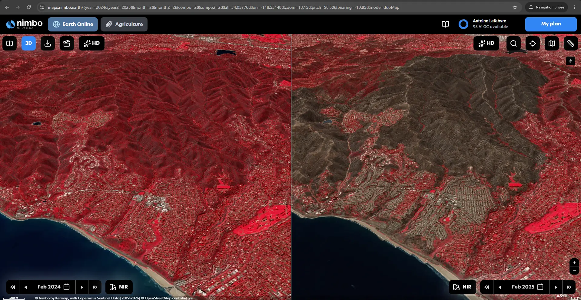
Switch to 3D view to explore satellite imagery in the context of terrain and elevation.
View in Near Infrared